Events/Attractions
Events/Attractions
Home NEW Updates About Us Feedback Historic Sites Consultants Contact Us Terms/Conditions
|
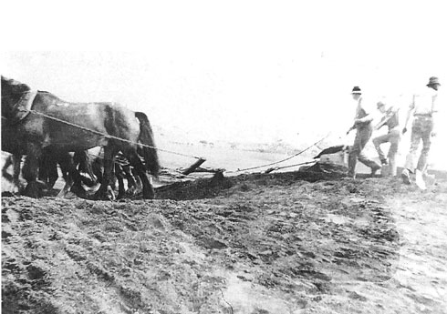
FLOODS IN GNOWANGERUP 1917 - 2022 The local creek that flowed through the township of Gnowangerup and then skirted around the eastern side, past the common and then crossing the road to Borden. This crossing when disrupted, caused major transport problems. A decision was made to build a bridge in the late 1910s. Pictured here are workers scooping the creek bed in preparation to building the bridge.
|
|
PREPARING TO BUILD BRIGE ON GNOWNGERUP- BORDEN ROAD #1 |
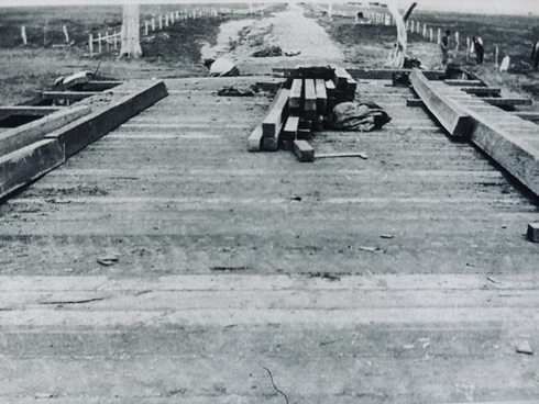
BUILDING BRIGE ON GNOWNGERUP- BORDEN ROAD #38 |
|
GNOWANGERUP CREEK IN FLOOD #2 |
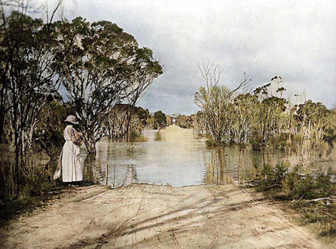
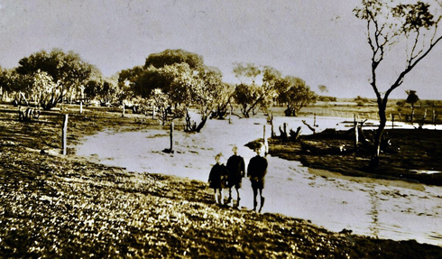
ADA VAUX AT FLOODED CROSSING #3 |
|
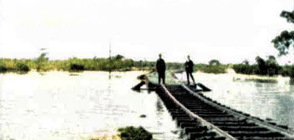
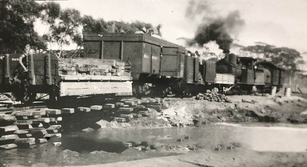
RAILWAY LINE DAMAGED BY THE FLOODS #4 |
|
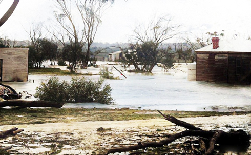
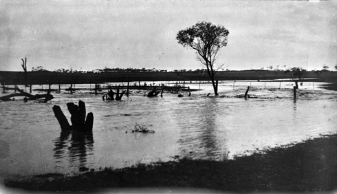
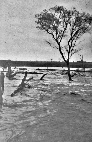
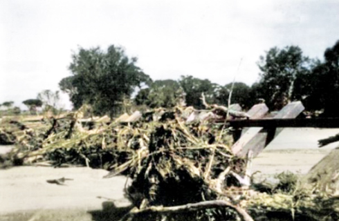
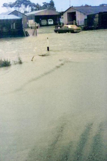
FLOODED FARM IMAGES #5 |
FLOODED FARM IMAGES #6 |
|
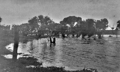
FLOODED FARM IMAGES #7 |
FLOODED FARM IMAGES #8 |
|
|
|
DAMAGE TO THE RAILWAY LINE #10 |
DAMAGE TO THE RAILWAY LINE #11 |
|
DAMAGE TO THE RAILWAY LINE #12 |
|
DAMAGE TO THE RAILWAY LINE #13 |
DAMAGE TO THE RAILWAY LINE #14 |
|
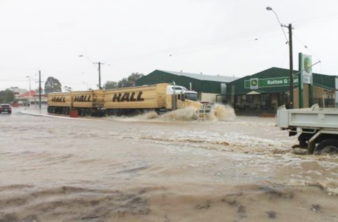
Floodwaters rushed through the machinery yard at the building supplies at one stage a huge. A truck tire was lifted bodily in by the torrent and disappeared amongst the floating debris. Two children at Corbett Street had the time of their lives riding the waves and rapids created by the runoff from the high ground. Despite heavy flooding and fast flowing water, the Gnowangerup Borden bridge withstood heavy pressure to remain undamaged. Water at least 6 m deep was pictured flowing under the bridge last Thursday afternoon. (Cranbrook also was flooded) The Gnowangerup Star |
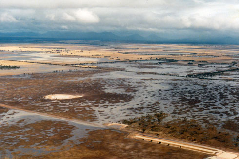
AERIAL VIEW OF FLOOD #15 |
|
BRIDGE CROSSING INFLOOD #16 |
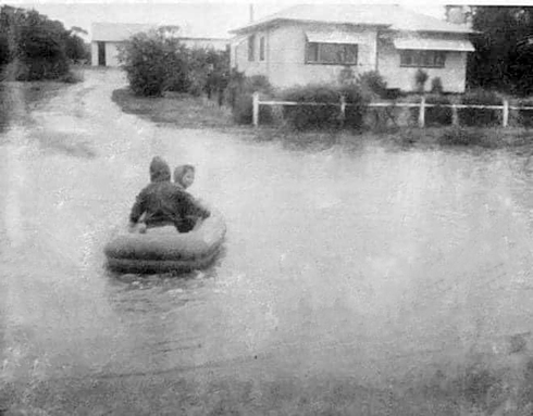
FUN IN THE FLOOD #17 |
|
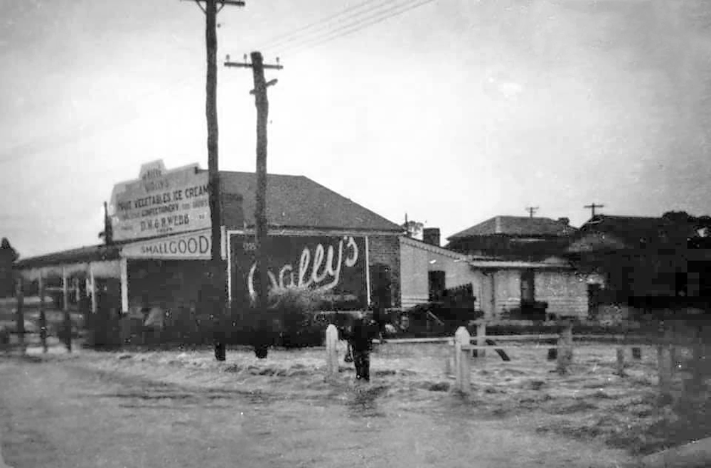
McDONALD STREET #18 |
|
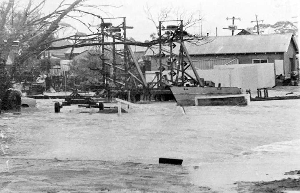
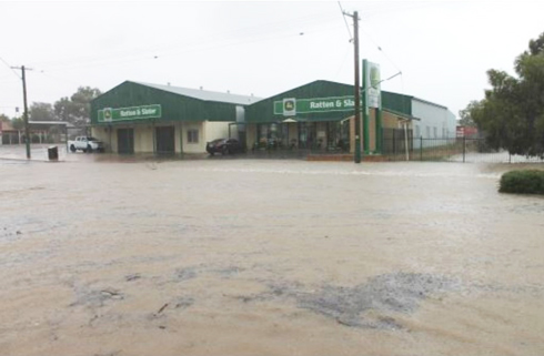
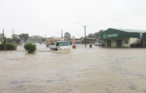
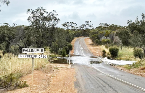
2012 FLOODS 2012 July · PALLINUP RIVER FLOODING LEAVES ROAD "IMPASSABLE" Formby Road South is impassable at Pallinup River due to flooding, according to Main Roads. The river is about 10km south of Gnowangerup-Jerramungup Road. Main Roads says the river rose overnight across the road. GNOWANGERUP ROAD BOARD MACHINERY YARD #19 |
GNOWANGERUP ROAD BOARD MACHINERY YARD #20 |
|
CREEK CROSSING ON YOUGENUP ROAD #21 |
CREEK CROSSING ON YOUGENUP ROAD #22 |
|
CREEK CROSSING ON YOUGENUP ROAD #23 |
CREEK CROSSING ON YOUGENUP ROAD #24 |
|
CREEK CROSSING ON YOUGENUP ROAD #25 |
CREEK CROSSING ON YOUGENUP ROAD #26 |
|
#27 |
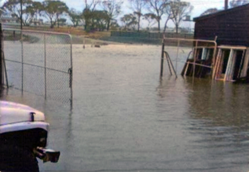
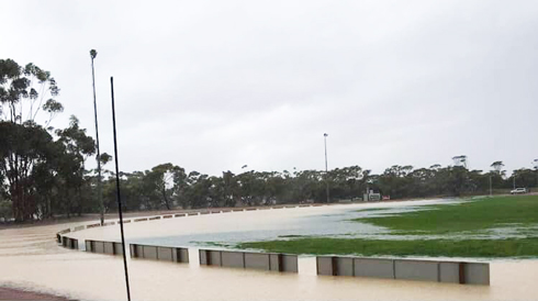
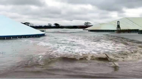
GNOWANGERUP SPORTS OVAL #28
PICTURE AT THE LEFT
|
|
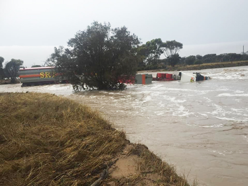
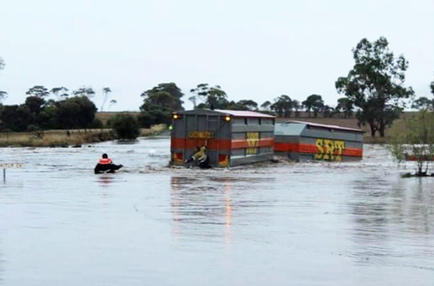
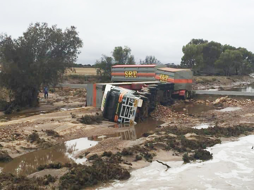
TRUCK WASHED AWAY #29 |
TRUCK WASHED AWAY #30 |
|
|
|
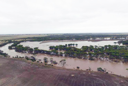
AERIAL VIEW OF FLOOD #33 |
GRAIN STORAGE BINS IN FLOOD #34 |
|
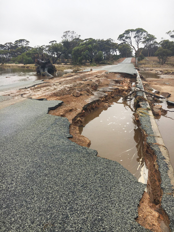
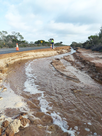
FLOODED ROADS #35 |
FLOOD DAMAGED ROADS #36 |
|
|
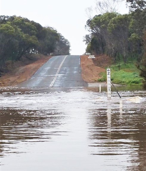
PALLINUP RIVER CROSSING IN FLOOD #37 |
|
Every endeavour has been made to accurately record the details however if you would like to provide additional images and/or newer information we are pleased to update the details on this site. Please use CONTACT at the top of this page to email us. We appreciate your involvement in recording the history of our area.
|
|
References: Article: Gnowangerup Star Newspaper Image: Pearl Marshall 1, 4
Copyright : Gordon Freegard 2024 |